
Antarctic Convergence- the Southern Ocean’s Natural Boundary
The Antarctic Convergence is a circumpolar ocean boundary. At this front, cold Antarctic waters meet warmer sub-Antarctic waters. The denser Antarctic water sinks beneath the lighter water, which drives strong mixing and nutrient upwelling. As a result, the zone supports some of the most productive ecosystems on Earth. Oceanographers also call it the Antarctic Polar Front.
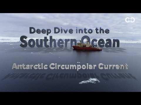
It is often confused with the Antarctic Circumpolar Current (ACC). The ACC is the continuous eastward current that flows around the entire continent, driven by strong westerly winds. In contrast, the Antarctic Convergence is the boundary within that current system where distinct water masses meet. The ACC transports vast volumes of water, while the Convergence marks the sharp transition in temperature, salinity, and ecology. Both features are linked, but they are not identical.
Where it lies and what you notice on a cruise
The Convergence forms a shifting belt around Antarctica. It usually sits between 48°S and 60°S. Position changes with longitude, wind, and season.
Ships crossing the Drake Passage almost always pass through it. Therefore, most cruise passengers will encounter this transition. The sea-surface temperature can drop by several degrees within a few hours. At the same time, seabird populations change. Albatrosses and petrels begin to dominate as warmer-water species disappear. In addition, fog or low cloud may appear due to sharp contrasts in air and water temperature.
The boundary is not fixed. Instead, it meanders and sometimes broadens. Therefore, each crossing feels slightly different.

How the Antarctic Convergence works
Three main processes define the Convergence.
- Water-mass meeting and sinking
Cold, dense Antarctic surface water flows north with the Antarctic Circumpolar Current (ACC). When it meets warmer water, it sinks below. As a consequence, nutrients rise toward the surface. - Jets, gradients, and Ekman transport
The front coincides with strong eastward jets within the ACC. Moreover, sharp temperature and salinity differences mark its position. Wind also plays a key role. When wind blows across the Southern Ocean, the surface layer of water does not move in the same direction. Instead, due to the Earth’s rotation, it moves at an angle. This process is called Ekman transport. In the Southern Hemisphere the net movement is about 90° to the left of the wind. As a result, winds around Antarctica push surface waters away from the continent, which allows deeper water to rise. At the Convergence, Ekman transport enhances mixing by shifting surface waters and driving vertical circulation. - Productivity and food webs
Mixing and upwelling promote high primary productivity. Therefore, the region sustains vast numbers of Antarctic krill. These in turn support whales, seals, and penguins.
How we discovered the Antarctic Convergence and how it’s mapped
Explorers first noticed the Convergence in the early 20th century. Ship logs showed sudden drops in sea temperature and distinct changes in marine life. By the 1930s, scientists such as George Deacon had described the front using systematic hydrographic surveys.
Instruments used at sea
Traditional mapping relied on hydrographic casts. Instruments lowered from ships measured temperature and salinity at different depths. Early devices included reversing thermometers and water-sampling bottles. Today, researchers use CTD profilers (conductivity, temperature, depth) to give precise vertical profiles. Ships also tow continuous thermosalinographs that log surface temperature and salinity in real time as the vessel moves. These records reveal exactly where the front lies during each transect.
Satellites and remote sensing
Since the 1970s, satellites have transformed how scientists track the Convergence. Instruments such as microwave radiometers and infrared scanners measure sea-surface temperature globally, even through cloud. In addition, altimeters map sea-surface height, which shifts across currents and fronts. As a result, researchers can now follow the Convergence weekly, rather than only when ships cross it.

Autonomous platforms
More recently, fleets of Argo profiling floats and autonomous gliders have joined the effort. These instruments drift or are piloted through the Southern Ocean, transmitting temperature, salinity, and current data via satellite. Because they operate year-round, they provide data even during the Antarctic winter when ships are absent.
Who does this work
The mapping is carried out by a wide network of organisations. National Antarctic programmes, such as the British Antarctic Survey, NOAA (United States), and CSIRO (Australia), all contribute ship and satellite observations. The Argo programme coordinates thousands of floats worldwide, including in the Southern Ocean. International groups such as the Southern Ocean Observing System (SOOS) bring these efforts together to give a unified picture.
What this tells us
Thanks to these methods, the Antarctic Convergence is now mapped with far greater accuracy than in the past. Scientists can see how the front meanders from week to week, and they can detect long-term shifts caused by climate change. For cruise passengers, this means the point where the ship “crosses the line” is identified with confidence, often announced by expedition staff on the bridge.
What the Convergence tells us about the oceans
The Antarctic Convergence marks more than a line on a map. It signals a boundary of global importance.
-
Climate and ecology: It separates sub-Antarctic and Antarctic waters. Consequently, marine species differ sharply north and south of the line.
-
Global circulation: It is part of the ACC, which helps drive the global overturning circulation. Therefore, it shapes the storage of heat and carbon in the oceans.
-
Atmosphere–ocean coupling: The front shifts with the westerly winds. As a result, it helps scientists measure wider climate change.
Climate change- what is changing and why it matters
The Antarctic Convergence is not a fixed line. It shifts naturally with winds, seasons, and currents. However, climate change is now altering its behaviour in measurable ways.
Poleward movement of winds and fronts
The westerly winds that circle the Southern Ocean have strengthened in recent decades. They are also moving further south. As a result, the Antarctic Convergence and neighbouring fronts are migrating poleward. This shift changes where the Convergence sits relative to established cruise routes. Some voyages now cross the front further south than they did several decades ago.
Freshwater input from melting ice
Glacial melt and ice-shelf collapse add large volumes of freshwater to the Southern Ocean. This input increases surface stratification, which means that lighter water sits above heavier water more strongly. Consequently, mixing weakens in some regions. A more stable surface layer can also slow the Antarctic Circumpolar Current. If the current weakens, the shape and intensity of the Convergence will be altered.
Ocean heat uptake and carbon storage
The Southern Ocean absorbs more than one-third of the carbon dioxide taken up by the world’s oceans. It also stores a significant portion of global ocean heat. Because the Antarctic Convergence is central to mixing, any change in its position affects how much heat and carbon reach deeper waters. In recent decades, the strongest uptake zones have moved closer to Antarctica. Therefore, the Convergence plays a growing role in global climate regulation.
Impacts on ecosystems
Biological consequences follow from these physical changes. Krill populations, which depend on nutrient-rich waters, may shift in distribution. Seabirds and whales that feed on krill must adapt by moving with them. Penguins and seals that breed in fixed locations are less flexible. Therefore, shifts in the Convergence affect entire food webs.
Why it matters to travellers
For cruise passengers, these changes may not always be obvious during a single voyage. Yet, over time, the Convergence will sit further south, and ecosystems will adjust. Guides often highlight this trend to explain why the Southern Ocean is a key focus of climate research.
What you experience crossing the Convergence on an Antarctic cruise
Passengers usually notice four things while crossing the Antarctic Convergence:
- Temperature shift: Expedition staff often highlight a sudden fall in surface temperature.
- Wildlife turnover: Birds adapted to colder waters replace species from the north.
- Ocean texture: The sea may show streaks of foam, sharper swells, or sudden fog.
- Context from guides: Naturalists explain why the Convergence matters for climate and biology.
Therefore, crossing the Convergence is more than a navigational milestone. It is also a vivid lesson in ocean science.
Key takeaways
-
The Antarctic Convergence is a moving ocean boundary where Antarctic and sub-Antarctic waters meet.
-
Its mixing drives nutrient upwelling and supports krill and higher predators.
-
It is part of the Antarctic Circumpolar Current, which influences global circulation.
-
Climate change is altering its position and behaviour.
-
On a cruise, passengers often experience it as a sudden shift in conditions.
Further Information
Wikipedia has a good summary about the Antarctic Convergence.
Wayfinders also has a good article about the Antarctic Convergence
Back To Top